Kingston - Kimmeridge, West Circular Route to include the Nodding Donkey
Area
|
Distance
|
Difficulty
|
Access Restrictions ?
|
Kingston/Kimmeridge
|
7 miles
|
Medium
|
Yes - See Range Opening times link on the Home Page
|
An excellent walk with great Ridgeway views, a walk through Kimmeridge village, a coastal walk past the 'Nodding Donkey' oil extraction site, the new Clavell's Tower and finishes with a visit to Swyre Head, the highest point on the Purbeck Hills.
|
|
Below are the details of the walk and also in PDF format for printing: 
Walk details:
How to get there: - Grid Reference; SY 943793. The walk starts at the car park at the
entrance to Encombe Estate. Head up into Kingston by turning right just after Corfe
Castle village and turn right at the sharp left-hand bend at the Scott Arms. Park in the car
park at the end of the tarmac road after (2/3 mile).
Information:-
No toilets here but there are in Kimmeridge at the Clavell's café/shop and at Kimmeridge Bay.
As you leave the car park, do not go left through the entrance to Encombe House but carry on up the track.
Continue to bear left along the track and onto the grassy path until you go through the large metal gate and reach ridge the top of the Ridgeway. You are now at Heaven’s Gate and this is written on the small gate to your left.
Turn right here and proceed along the Ridgeway until you drop down to the road (1 mile).
Turn left here down to the junction (60 metres). Cross the road and over the stile with the finger post to the right and out along the Ridgeway. Just after the MOD gate, which restricts access when the Ranges are closed, bear left down the hill and follow the path down to meet the coast path.
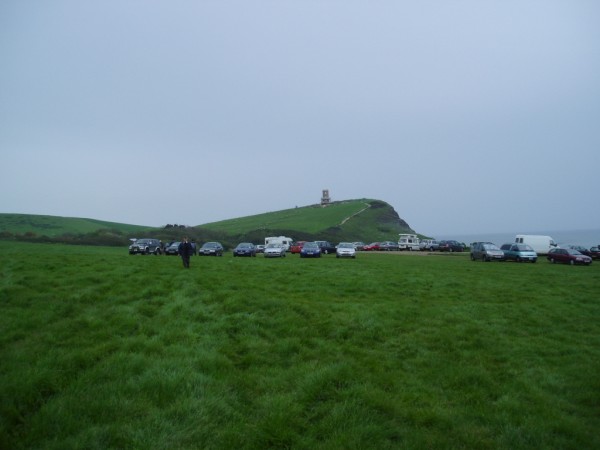
Turn left, through the gate, and follow the coast path, past the 'Nodding Donkey' oil extraction site and follow the path onto a large expanse of grass with Clavell's Tower ahead
Proceed to the right corner, along the path and past the toilets on your left to meet a tarmac road (250 metres). Turn right, down the road for 50 metres and then left, up the steps, following the finger signs for Chapman’s Pool.
At the top you will pass the new Clavell’s Tower, moved 80 feet back from the cliff edge to avoid it falling into the sea.
Follow the coast path for 1 ½ miles until meeting a stile to your left at Rope Lake Head. Go over this stile and head up to Swyre Head, taking take to keep left to follow the signs and not turn right along the track. This is quite a steep climb at the end but it is the last one and the views are worth it!
You are now at Swyre Head. Proceed straight ahead towards the wall with the woods to the left and follow the path down to the car park (2/3 mile).
Jurassic Jaunts
© Jurassic Jaunts AP 2009